GeoSpy is a purpose-built tool for geospatial intelligence
Meet the platform for modern geolocation analysis. Streamline image interpretation, multi-image investigations, and global insights.

From Quick Decisions to Deeper Insights
A Feature-Rich Platform for Intelligent Geolocation
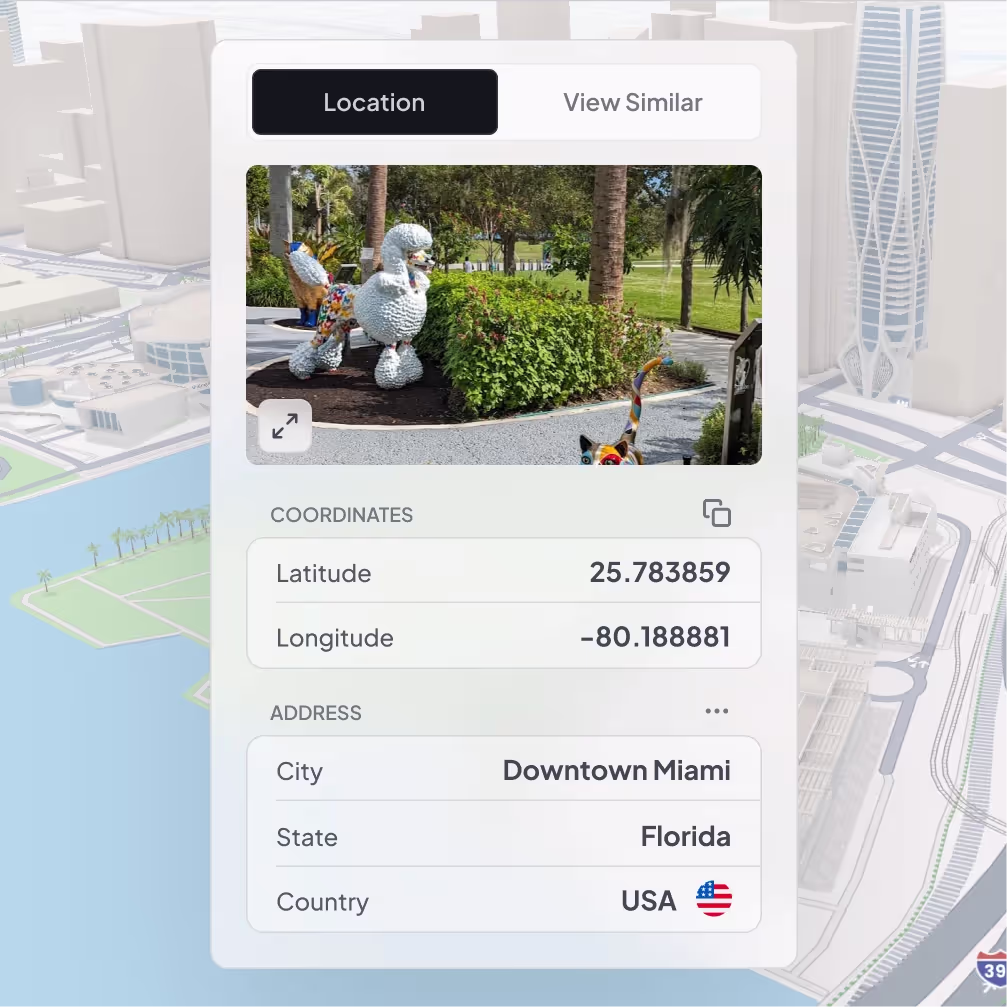
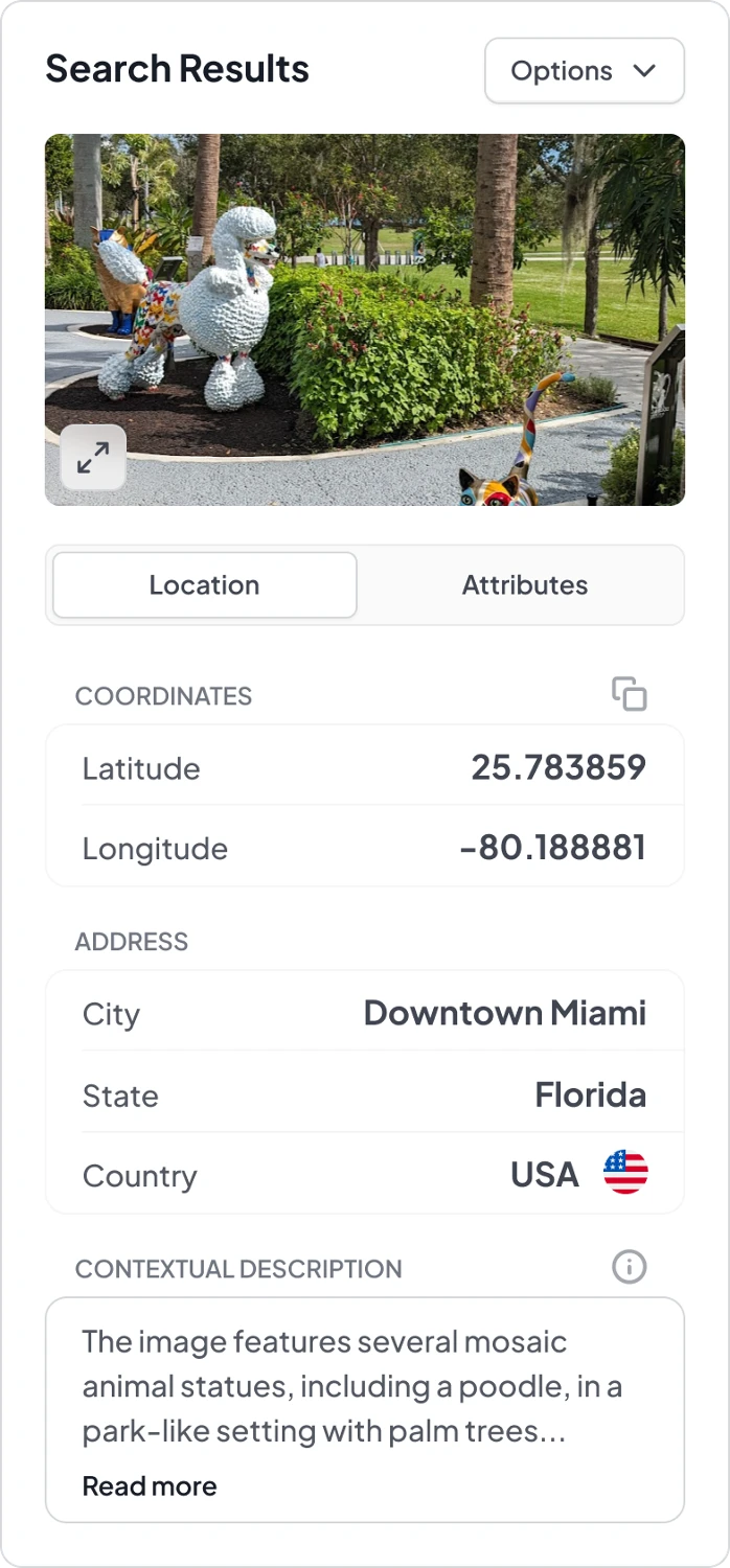
Instant Location Pinpointing
Upload an image and discover where in the world it was taken, down to the city and country level.
Contextual Validation
Gain transparency into GeoSpy’s reasoning, with cultural, environmental, and architectural cues informing every prediction.
Limitless Applications for All
From casual discovery to enterprise-scale security and intelligence missions—GeoSpy is ready for your workflow.

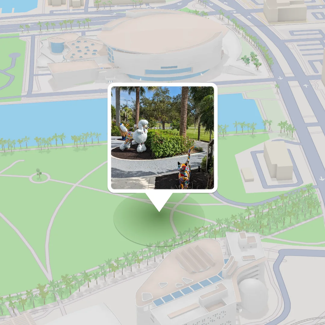
From a Single Photo to a Rich Geospatial Map
Upload your first image and watch GeoSpy reveal the precise coordinates, relevant context, and key markers that define the landscape.
Image-to-Location Mapping
Instantly move from raw visuals to pinpointed coordinates.
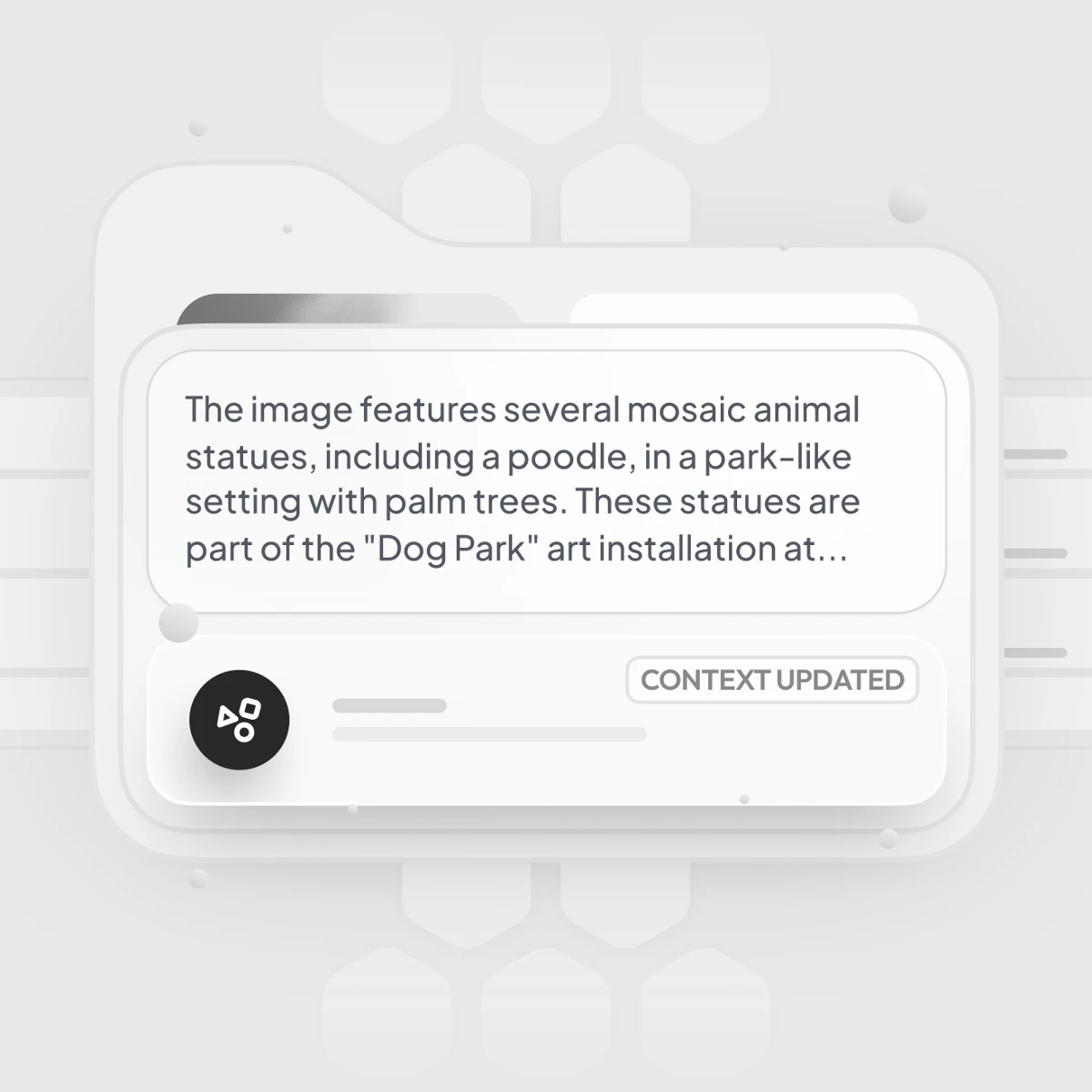
Cultural Markers.
Environmental Context.
Identify architectural styles, local vegetation, or recognizable landmarks that validate GeoSpy’s predictions.
Faster Insights.
Less Guesswork
Eliminates hours of manual research, giving you immediate clarity on any outdoor scene.
Immersive 3D Visualization for True Spatial Awareness
Break free from flat maps. Experience locations in three dimensions to gain a more intuitive understanding of the environment.

Authentic Spatial Context
Visualize building heights, terrain contours, and infrastructural layouts.
Enhanced Sitational Awareness
Perfect for security personnel, urban planners, and educators seeking deeper insights.
Gain trust in any prediction.
Validate the plausibility of geolocation results by comparing them against realistic urban forms.
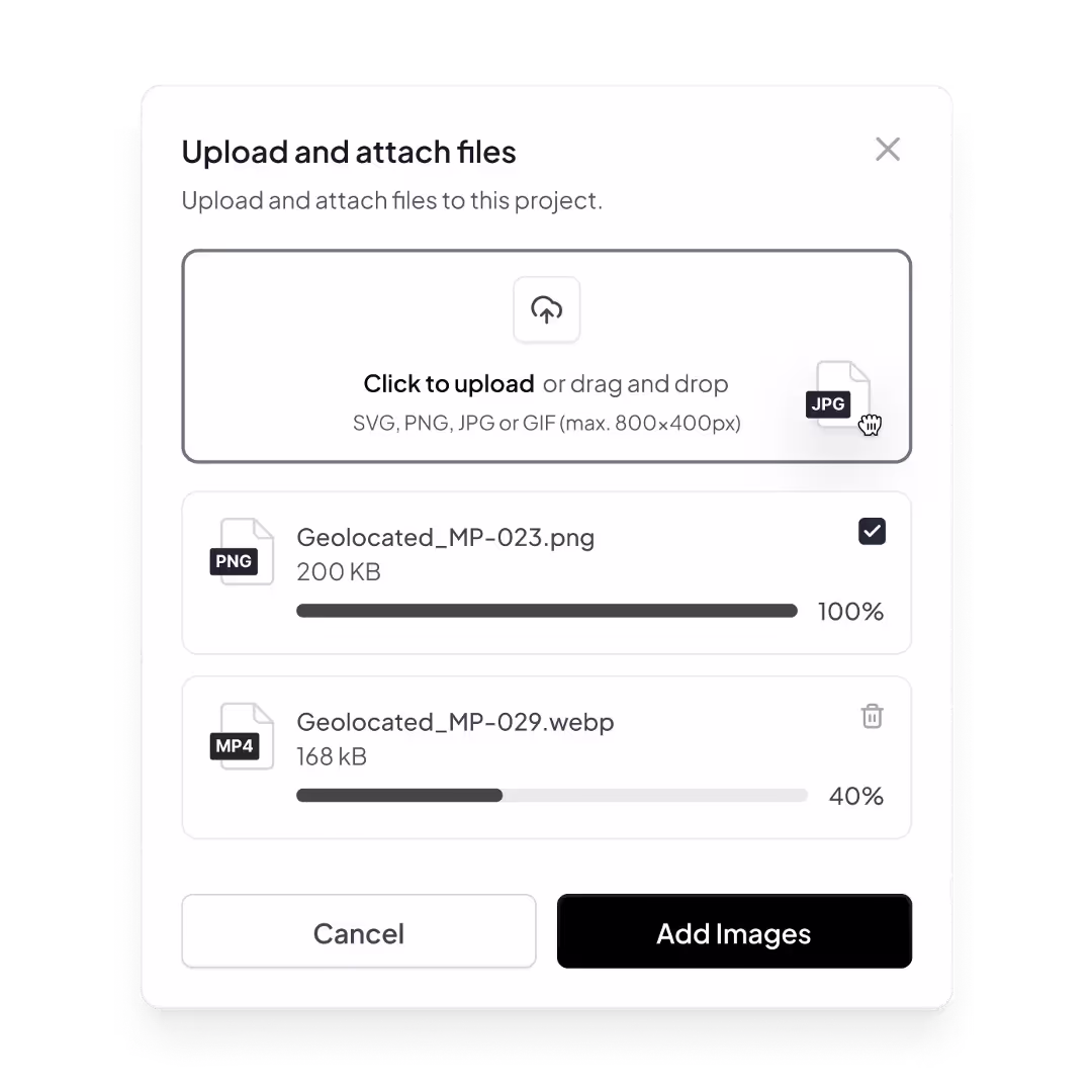
Scale Your Analysis with Multi-Image Projects
Take your investigative capabilities to the next level. Batch-upload multiple images and consolidate intelligence in a unified dashboard.
Holistic Perspective
Correlate visual data from various sources to produce richer, more reliable insights.
Streamlined Workflow
Handle large-scale investigations efficiently, perfect for government agencies, educators, and OSINT analysts.
Higher Accuracy
Multi-image analysis strengthens predictive confidence, ensuring data-driven decision-making for complex projects.
Contextual Image Matches: Deeper Understanding Through Comparisons
With one click, uncover a curated set of visually similar images
Visual Contextualization
Visual Contextualization: Identify patterns, recurring themes, or regional aesthetics tied to the original image.
Enhanced Validation
Enhanced Validation: Cross-verify initial findings against a broader dataset, reinforcing confidence in your geolocation.
Accelerated Research
Rapidly surface related visuals, saving time and expanding the depth of your analysis.
Collaboration & Project History
Work seamlessly across teams, revisit past analyses, and refine your strategy over time.
Centralized Project Archive
Easily access previous investigations, compare historical data, and track progress.
Collaborate Seamlessly
Easily access previous investigations, compare historical data, and track progress.
Continuous Improvement
Build on past discoveries, refine your techniques, and cultivate a knowledge-rich investigative environment.
Flexible Deployment & Integration
GeoSpy adapts to your workflows and toolchains, enabling smooth, efficient integration into your existing processes.
On Edge
Deploy our technology in the field or at secure on-premise locations to meet your organizational requirements.
Developer Friendly
Integrate via API into your proprietary systems, dashboards, or products for a seamless user experience.
Under the Hood
GeoSpy’s predictions and machine learning are powered by cutting-edge models, trained on extensive image-GPS pairs and refined with the latest AI advancements.
What will you uncover?
Sign up now and upload your first image to see GeoSpy in action.